Showing posts with label Barkhamsted. Show all posts

Friday, June 29, 2012

Barkhamsted - Indian Council Caves

Date Hiked:  Thursday, June 28, 2012
Number in Group:  9
Estimated distance round-trip: 2 miles
Weather:  Sunny and warm, 92°F
Resources:  Connecticut Walk Book: West put out by CT Forest & Park Association
Highlights of the trip: Ginormous boulders to climb on

On Thursday, we took a hike to the Indian Council Caves in Barkhamsted.  There were several places we could have parked along Route 179, but we decided to park on Legeyt Road about a mile north of where Routes 179 and 219 intersect.  This makes for a relatively short and easy hike.

Crossing to the west side of 179, we went past a yellow gate and onto the trail. I believe this part of the trail used to be an extension of Legeyt Road and skirts the edge of Tunxis State Forest.  While it still looked like a roadbed, there was only a single-person track through the grass and weeds. 

Majestic looking tree.
Before too long, the trail became very rocky.  It resembled a dry stream bed.


Along the way, we came to two ponds.  The first one was right by the trail and easy to access.  We didn't see a lot, but we could hear the bull frogs.  The second one could be glimpsed through the trees and there appeared to be a beaver lodge.

First pond.

Any idea what this is?
There were also a number of cellar holes.  I think we came across at least three.  This one appeared to have stairs.  The flat rock in the foreground of the picture also had what appeared to be a circular opening.  Not sure what that was.


We had already gone past a trail on the right that was blazed blue.  This was the Tunxis Trail heading north toward the Massachusetts border.  A little further on, we came to another blue blazed trail on the right.  The Tunxis Trail turns in here for the Indian Council Caves.  (I think if you continued along the old road, you might connect with the Tunxis Trail south of the caves).

The kids had gone on ahead of us and were already on top of the boulders by the time the adults got there.


Near the top.
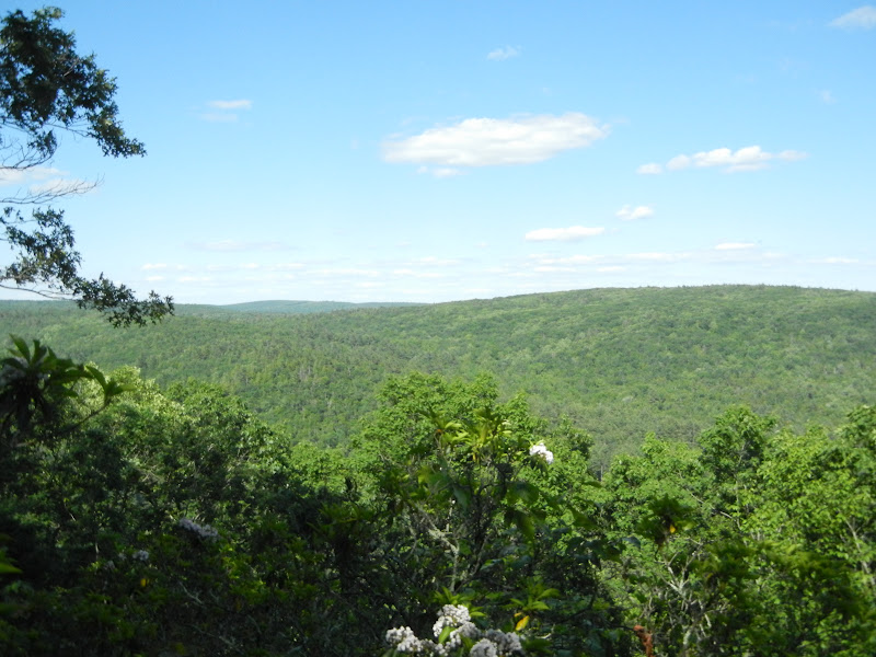
There is really no view to speak of other than the tops of lots of trees.  Still, it's fun to sit way up on top of the boulders.


The rocks form a protective circle.


Jewel weed.
The route we took made this a short, but enjoyable hike.  If you don't have a lot of time, or are with young kids who may not be able to hike from some of the other trail heads, I would recommend taking this route.  Details on the other parking areas are listed in the Connecticut Walk Book: West which you can find in most libraries.

Friday, June 8, 2012

Barkhamsted - People's State Forest

Date Hiked:  Thursday, June 7, 2012
Number in Group:  9
Estimated distance round-trip:  2.5+ miles
Weather:  Sunny, 75°F
Website:  People's State Forest
Highlights of the trip: History of Barkhamsted Lighthouse community, tremendous views, Veeder Boulders


Looking at the trail map, we had agreed to meet at the Whittemore Grove parking area to begin our hike on the Jessie Gerard Trail.  However, when we arrived we found that there was a small parking area on East River Road just opposite the trail head.

The plan had been to hike up the Jessie Gerard Trail until it met the Robert Ross Trail, head north to the various lookouts, and then return via the Falls Cut-off Trail.  Part way up the Jessie Gerard Trail, we stopped to read about the Barkhamsted Lighthouse Cemetery.  We met a couple coming down the trail who suggested that we, instead, go up the Falls Cut-off Trail and down Jessie Gerard.  This turned out to be good advice as the Falls Cut-off Trail was much steeper and would have wreaked havoc on the knees on the way down.

Rather than backtracking, we were able to use the Lighthouse Trail (not shown on the trail map) to cut back over to the Falls Cut-Off Trail.  Along the way we got a little history lesson on the Barkhamsted Lighthouse Village.  A strange name for a place in the middle of the woods, but it got its name because it was a beacon for travelers on the road below.  The light from the village served as a mile marker of sorts.  Rather than rewrite what has already been written about the Barkhamsted Lighthouse, I will direct you to Steve Wood's Connecticut Museum Quest website for more information.

Description of Lighthouse Cemetery with one of the stones to the left near the flag.

More gravestones.
The cellar hole at the base of the tree.
Quarry.

This grind stone was pretty cool.

Hard to see, but the slightly raised area in front of the sign was a charcoal kiln.
After taking the time to read about this settlement, we arrived at the Falls Cut-off Trail and started to climb.  In some areas, I had to use my hands to help me over a rock.  It was pretty steep, but we weren't in any hurry.  Plus, I have found that if you stop to take pictures for your blog, you can take a breather.  (By the way, on the trail map, the Falls Cut-off Trail is supposed to be blazed blue/red, but it is blazed blue/yellow like the Jessie Gerard Trail).


Going up, up, up.


Cliff on one side of the trail.

"X" marks the spot.  Buried treasure, Becca?
There is a little trickle of a stream, but it is hard to see.


Looking back down from the top.

Though the climb to the top was a bit of a workout, it was worth it.  The views were tremendous.  We really lucked out with the weather.  There had been rain predicted all week, but instead, we got fabulous cloud formations that added to the view.

Looking south along the West Branch of the Farmington River.
Along the river, across from the lookout,
was the bridge abutment we stood on during last week's hike.
At the next lookout, we could see north to Riverton.
The trail then left the ridge and headed off into the woods.  Before too long, we came upon the Veeder Boulders.  These large glacial erratics just seem so out of place in the middle of the woods (hence, the name erratic, I guess).  The kids tried to climb them, but didn't have any luck.  I teased them that I would be able to find pictures online of people on top of the boulders, but I stand corrected.


Veeder boulders.

We continued through the woods, toward Greenwoods Road, but with an eye out for an unmarked trail to the left.  Based upon the trail map, it appeared that this would connect to Kiwanis Road and that there would be another overlook at the end.  We found the trail.  It had snowmobile markers along it, which corresponds with the map, but it was overgrown and very wooded.  The trail started to curve back around to the right which made me think we had already connected to Kiwanis Road.  There did not appear to be any place that looked like it would offer an overlook, so we decided to turn back.  We returned the same way we had come until we got back to the Falls Cut-off Trail.  Instead of turning to go down here, we continued straight over a small log bridge on the Robert Ross Trail.  We followed this until we came to the Jessie Gerard Trail and headed back down to the cars.

We certainly got a workout on this hike, but it was a lot of fun, too.  I suspect we will be back to People's State Forest to check out some of the other trails.
 

Saturday, June 2, 2012

Barkhamsted - American Legion State Forest

Date Hiked:  Thursday, May 31, 2012
Number in Group:  8
Estimated distance round-trip:  Henry Buck Trail - 2 miles, Turkey Vulture Ledge Trail - 0.8 miles
Weather:  Sunny, 81°F
Website:  American Legion State Forest
Highlights of the trip: View to Ski Sundown, flowers, West Branch of Farmington River

After a couple of days of yucky, humid weather, we were treated to a day that was perfect for hiking.  Parking on the side of West River Road just past Legion Road, we headed into the woods on the Henry Buck Trail.


The first part of the trail is a relatively easy walk through a hardwood forest.  There were lots of ferns and wildflowers on the forest floor.  While we unfortunately seemed to be a week or two too late for the trillium, we did see some other wildflowers that I had never seen before.

Using the Connecticut Botanical Society's website, I think I have identified the following plant as Virginia Waterleaf.  It is considered rare in CT.  Makes me wish I had taken a better picture.


Virginia Waterleaf
The trail then becomes much more rugged, and steeply sloped.  If it were wet, I would think the footing could be tricky.


Ferns are cool.

So are mushrooms.

A little way up the trail, we came to the remains of an old cheese box factory.  Here is a description from the DEP Letterboxing website:


The trail turns sharply up hill following a streambed. Notice many steps in the trail that were created when the C’s did the construction.  After about ¾ of a mile, the trail somewhat levels out and you will notice an old “cellar hole” and a large stonewall just behind it.  This is not a cellar hole!  It is the remnants of the old cheese box factory that operated in the early 1800’s.  They made wooden boxes to store and ship locally-produced cheese.

The stonewall is actually part of the foundation and the factory extended out over the ‘cellar hole’!   Water was directed into what looks like a stairway into the cellar hole via a sluiceway.  The water turned a paddle in this ‘cellar hole’ that was connected to a gearbox that, in turn, provided power up to the factory! The wooden sluiceway must have been in the area where the trail proceeds to an old, washed out earthen dam. The small reservoir that was created by this dam provided the water necessary to power the cheese box factory.


"Cellar hole" now has a birch tree lying across it.

"CG" couldn't join us this time, but it appears she left her mark!


The Mountain laurel were in bloom.

One of the things we were supposed to see as we walked along the "Tremendous Cliffs" was a plaque honoring Henry Buck, the person for whom the trail is named.  Perhaps I was distracted by the youngest member of our group, who was thinking of the "cliffs of insanity" when she started quoting Inigo Montoya.  "Hello. My name is Inigo Montoya.  You killed my father.  Prepare to die."  Or, more likely, I was spending too much time with my eyes on the ground, so that I didn't end up on the ground, and I missed things.   Like the plaque.  Anyway, we eventually came to an overlook with a nice view of the valley over to Ski Sundown in New Hartford.


Ski Sundown in the distance.

We continued our hike back down toward the road, passing quite a few glacial erratics and this rather odd looking tree trunk.


When we got back to the road, we crossed over to the other side and walked along the West Branch of the Farmington River.  The views were spectacular.


Looking south.


Fisherman.


Mama duck and Jack, Kack, Lack, Mack,...


Remnants of an old bridge.

We got back to our cars and headed up Legion Road to the trail head for Turkey Vulture Ledges.  Legion Road is a dirt/gravel road, but was in pretty good shape.  The sign for the trail head was down, but there is a fairly obvious pull off and the blue blazes are easy to see from the road.  A quick 0.4 of a mile and we were at the ledges, again looking over toward Ski Sundown.


I really enjoyed these two hikes.  While there were some more strenuous areas, they were interspersed with flatter areas that allowed us middle-aged folks to catch our breath.  I'd like to come back next spring and get a look at more of the wildflowers on the Henry Buck Trail.  Across the river is People's State Forest which has a much larger trail system and is on our agenda for future hikes.

If you would like to read more about these trails, you can look at the website for American Legion and People's State Forests.  There is a good trail map online.  I also recommend reading Steve Wood's humorous and informative account of his hike at his website Connecticut Museum Quest.  (That's how I knew about the cheese box factory and the plaque that I missed).  Jim Colleran has a nice summary of his hike on his blog A Walk Across the Giant.