Saturday, June 2, 2012

Barkhamsted - American Legion State Forest

Date Hiked:  Thursday, May 31, 2012
Number in Group:  8
Estimated distance round-trip:  Henry Buck Trail - 2 miles, Turkey Vulture Ledge Trail - 0.8 miles
Weather:  Sunny, 81°F
Website:  American Legion State Forest
Highlights of the trip: View to Ski Sundown, flowers, West Branch of Farmington River

After a couple of days of yucky, humid weather, we were treated to a day that was perfect for hiking.  Parking on the side of West River Road just past Legion Road, we headed into the woods on the Henry Buck Trail.


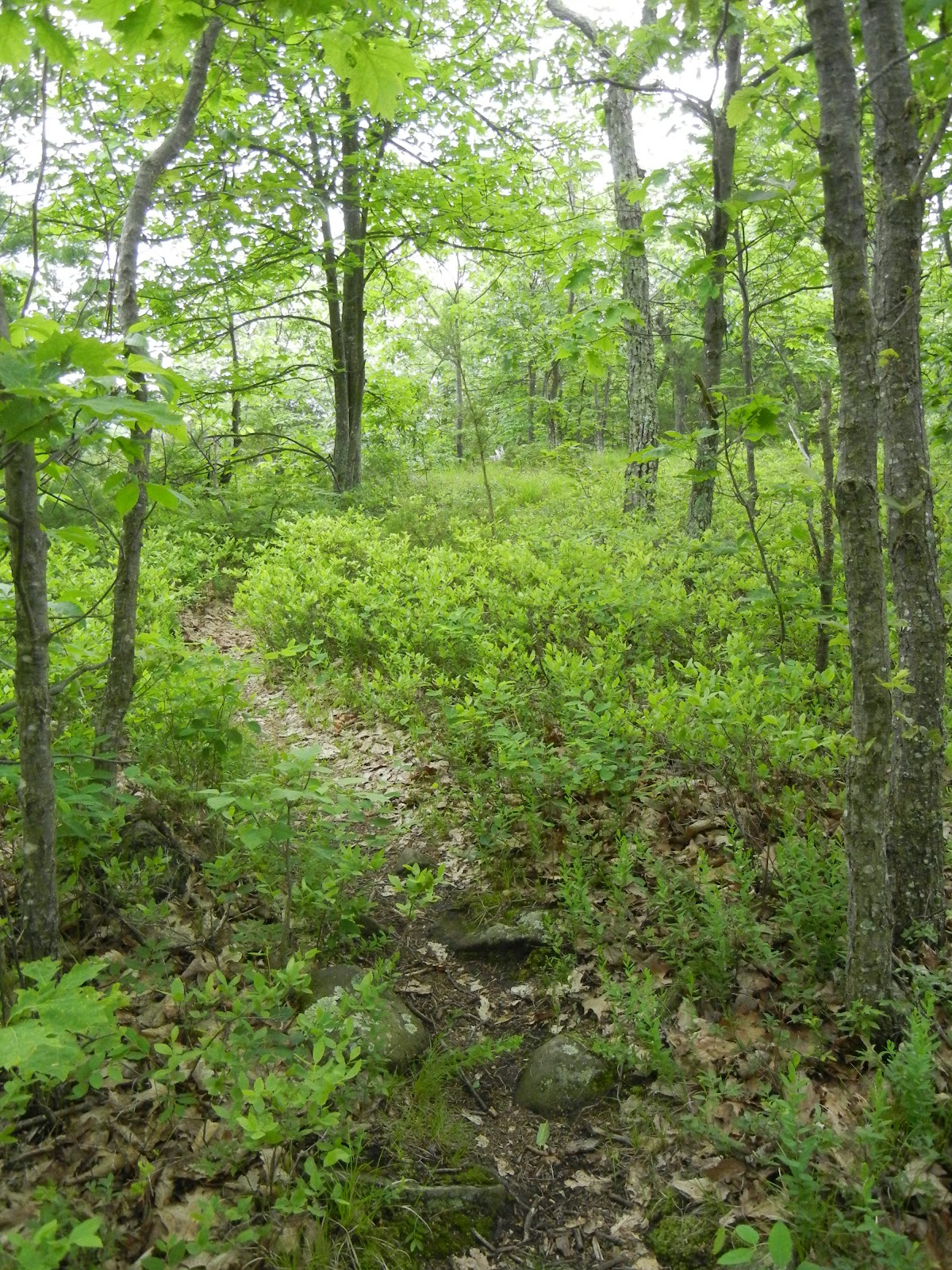
The first part of the trail is a relatively easy walk through a hardwood forest.  There were lots of ferns and wildflowers on the forest floor.  While we unfortunately seemed to be a week or two too late for the trillium, we did see some other wildflowers that I had never seen before.

Using the Connecticut Botanical Society's website, I think I have identified the following plant as Virginia Waterleaf.  It is considered rare in CT.  Makes me wish I had taken a better picture.


Virginia Waterleaf
The trail then becomes much more rugged, and steeply sloped.  If it were wet, I would think the footing could be tricky.


Ferns are cool.

So are mushrooms.

A little way up the trail, we came to the remains of an old cheese box factory.  Here is a description from the DEP Letterboxing website:


The trail turns sharply up hill following a streambed. Notice many steps in the trail that were created when the C’s did the construction.  After about ¾ of a mile, the trail somewhat levels out and you will notice an old “cellar hole” and a large stonewall just behind it.  This is not a cellar hole!  It is the remnants of the old cheese box factory that operated in the early 1800’s.  They made wooden boxes to store and ship locally-produced cheese.

The stonewall is actually part of the foundation and the factory extended out over the ‘cellar hole’!   Water was directed into what looks like a stairway into the cellar hole via a sluiceway.  The water turned a paddle in this ‘cellar hole’ that was connected to a gearbox that, in turn, provided power up to the factory! The wooden sluiceway must have been in the area where the trail proceeds to an old, washed out earthen dam. The small reservoir that was created by this dam provided the water necessary to power the cheese box factory.


"Cellar hole" now has a birch tree lying across it.

"CG" couldn't join us this time, but it appears she left her mark!


The Mountain laurel were in bloom.

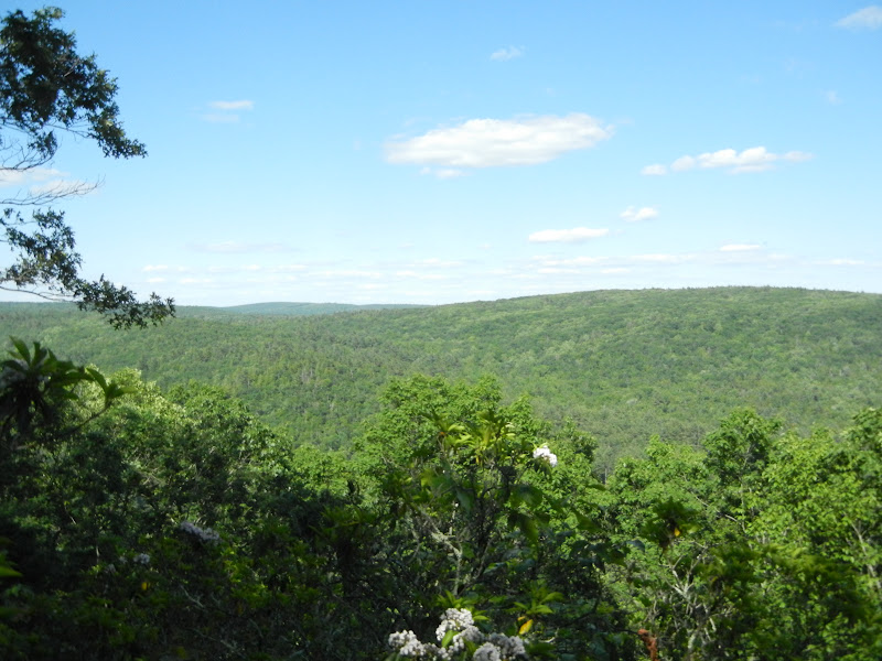
One of the things we were supposed to see as we walked along the "Tremendous Cliffs" was a plaque honoring Henry Buck, the person for whom the trail is named.  Perhaps I was distracted by the youngest member of our group, who was thinking of the "cliffs of insanity" when she started quoting Inigo Montoya.  "Hello. My name is Inigo Montoya.  You killed my father.  Prepare to die."  Or, more likely, I was spending too much time with my eyes on the ground, so that I didn't end up on the ground, and I missed things.   Like the plaque.  Anyway, we eventually came to an overlook with a nice view of the valley over to Ski Sundown in New Hartford.


Ski Sundown in the distance.

We continued our hike back down toward the road, passing quite a few glacial erratics and this rather odd looking tree trunk.


When we got back to the road, we crossed over to the other side and walked along the West Branch of the Farmington River.  The views were spectacular.


Looking south.


Fisherman.


Mama duck and Jack, Kack, Lack, Mack,...


Remnants of an old bridge.

We got back to our cars and headed up Legion Road to the trail head for Turkey Vulture Ledges.  Legion Road is a dirt/gravel road, but was in pretty good shape.  The sign for the trail head was down, but there is a fairly obvious pull off and the blue blazes are easy to see from the road.  A quick 0.4 of a mile and we were at the ledges, again looking over toward Ski Sundown.


I really enjoyed these two hikes.  While there were some more strenuous areas, they were interspersed with flatter areas that allowed us middle-aged folks to catch our breath.  I'd like to come back next spring and get a look at more of the wildflowers on the Henry Buck Trail.  Across the river is People's State Forest which has a much larger trail system and is on our agenda for future hikes.

If you would like to read more about these trails, you can look at the website for American Legion and People's State Forests.  There is a good trail map online.  I also recommend reading Steve Wood's humorous and informative account of his hike at his website Connecticut Museum Quest.  (That's how I knew about the cheese box factory and the plaque that I missed).  Jim Colleran has a nice summary of his hike on his blog A Walk Across the Giant.

Friday, May 25, 2012

Simsbury - Cathles Trail

Date Hiked:  Thursday, May 24, 2012
Number in Group:  11
Estimated distance round-trip:  1.2 miles
Weather:  Overcast, humid, 78°F
Highlights of the trip:  Waterfall, expansive views

This hike is in what the Simsbury Land Trust Walkbook calls the Western Highlands.   The Cathles Trail can be done as either an extension of a hike on the Hedgehog Trail or as a separate hike starting at the end of North Saddle Ridge Drive.  We decided to do it as a hike separate from Hedgehog. 

Before we even got into the woods, one of the kids spotted a millipede.  We took a few moments to observe and take pictures.  We needn't have worried about missing the opportunity.  We saw millipedes all along the trail.

One of many millipedes found along the trail.
A short walk along the white-blazed trail led us to this pretty little waterfall.


We started climbing the trail through the talus until we reached the bridge over the stream.  Immediately on the other side of the bridge is a jumble of rocks that forms a small cave.  The kids climbed around on this while they waited for us to decide in which direction to go.  According to a map located at the bridge, the white trail continues to the west where it connects with the blue-blazed trail.  The red-blazed trail follows the ridge line to the south along the Hedgehog Trail or to the north along the Cathles Trail.  We decided to stick with the Cathles today, so we crossed the bridge and continued north.  We will come back at some point in the future and do Hedgehog.

The cave.

The red trail wound it's way up the slope and along the ridge.  Some of the area here reminded me of Maine, with bare rocks and lots of blueberry bushes.

Cathles Trail.
Along this red-blazed trail, we had a little discussion about blazes.  In general, the trail is marked with a single vertical blaze.  When there is a turn, there will be two blazes offset from each other, with the top blaze indicating the direction to take.  For example, if the top blaze is set to the right of the bottom blaze, the trail will turn to the right.  Then we came to a double blaze where the blazes were not offset, they were aligned vertically.  I thought that this might mean the end of the trail, even though it seemed to continue and we did find blazes further on.  When we got back, I did a little research on the meaning of the blazes.  Some websites indicated that the vertically aligned blazes could mean caution and others indicated that you needed to look for a turn.  Here is a little chart I found that summarizes what the various blaze markings mean:

From the Finger Lakes Trail Conference website.
Along the ridge, we saw quite a few different wildflowers.  If you can identify them, leave a comment and I will add the appropriate caption.


Pink Corydalis

Lady slipper.
The views from the lookouts were quite impressive.  We could see well to the north, past the Barndoor Hills in Granby, and east to the Metacomet Ridge and beyond.


Barndoor Hills in Granby.  What is in the distance on the far left?

Looking east across the Farmington Valley to the Metacomet Ridge.
When we got to what we assumed was the final lookout, we turned around.  While the Walkbook indicates that the red trail linked up with the blue trail on the west side of the ridge, some of the other maps indicate that the trail just ends.  There did seem to be a narrow trail heading into the woods, but we decided to turn back.  An adventure for another day, perhaps.  

This was a great hike and much less strenuous than I feared.  The Western Highlands offer tremendous views of the valley and a hike along the Hedgehog Trail is in our plans for the future.


Saturday, May 19, 2012

East Granby - Cowles Park to Tariffville Gorge

Date Hiked:  Friday, May 18, 2012
Number in Group:  8
Estimated distance round-trip:  2 miles
Weather:  Absolutely perfect!  Sunny, 74°.
Highlights of the trip:  The Farmington River as it runs through the gorge.

I think we need to do this hike again.  I'll get to the reason why in a minute.

I could not find a trail map for this hike on-line.  I did find a map someone made using their GPS and planned on using that as a guide.  When we got to the park, there were some copies of a hand drawn map in the box at the trail head.  Trying to mash these two sources together, we headed north on the yellow trail, looped around to the south and after a little bit connected to the orange trail.

Our walk through Cowles Park itself was a nice enough, although unremarkable.  The trail was relatively flat, with several side trails that led to places unknown.  We followed the orange trail until we came to Tunxis Avenue.  The river was on the other side of the road.


A map I drew to show how to get from Cowles Park 
to the Metacomet Ridge overlooking Tariffville Gorge.

When we got to the Farmington River (outside Cowles Park boundaries), we followed a trail upriver a bit until we got to an area that looked like an old dam.  The water flow was pretty impressive, but I am sure it was nothing to what it could be during the spring thaw.  While we were there, two kayakers came through the rapids.

What looks to be part of an old dam.
Kayakers coming through the rapids.

Back up on Tunxis Avenue, we had the choice of returning the way we had come or completing the orange loop by walking down Tunxis Avenue toward Route 187.  Since we had already been out for awhile and the map indicated a steep, rocky area if we completed the loop, we decided to simply return the way we had come.  (This turned out to be a good idea - see below).

____________________________________________________________________________

Now to the reason we need to do this again.  If you look at the GPS map that I mentioned above, you will see that there are pictures that are synced up to the trail they took.  In some of those pictures, they are well above the river and have expansive views to the west with the Barndoor Hills in Granby clearly visible.  We did not get to this place.  I was kicking myself, because if I had more carefully studied their map before I left the house, it would have been obvious.

On Saturday, I decided to return to the park with a friend to figure out how to get to the Metacomet Trail.  It really wasn't that difficult, especially after running into my mailman on the trail in Cowles Park and getting a few instructions.  So here is what we did, so we know for next time:

We took the yellow trail as we did yesterday.  Where it meets up with the orange trail there is a bench.  A trail leads off to the right, behind the bench.  You cross over a small stream on a wooden bridge, start to climb a little hill until you come to the power lines (lots of clearing done here).  Cross the power lines and keep climbing until you reach the blue blazed Metacomet Trail.  Turn left and before too long, you will come to a path that goes off to the right (somebody has spray painted arrows on the rocks).  This leads you to an overlook where you can see the gorge, Tariffville, and the Barndoor Hills.  At this point, we became a little confused because there seemed to be blue blazes everywhere.  Do you stay close to the ridge and hope there is a way down, or go back to the area of trail  that you left?  We kind of took the middle road and kept losing and picking up a/the trail.  No matter.  We made it down to Tunxis Avenue eventually.  From there, we walked north along the road until it dead-ended (there used to be a bridge across the river, which I assume came down in the flood of '55).  Here, we were able to get close to the water and see the gates that are used in the kayak competitions. There were also several kayakers practicing their rolls.

(Note: At the end of the road, there was a red trail that went north under the area where the lookout was.  Does this trail climb up to the ridge?)

We returned to Tunxis Avenue and walked south. Yesterday, we had returned on the orange trail the way we had come.  My friend was willing to be adventurous, so we decided to complete the orange loop.  We continued down Tunxis toward 187 looking for a trail marker to lead us back into Cowles Park.  We saw a metal signpost with the top painted orange, but when we looked up the slope, there just didn't seem to be any clear trail.  We continued, but quickly got to 187.  There was a trail that seemed to go up here, but it essentially took you up to the highway.  I think the trail is at the orange-painted post, but it wasn't that clear, so we returned to the trail I had taken yesterday.

___________________________________________________________________________

I think we need to revisit this hike on a clear, crisp day this fall.

Saturday, May 12, 2012

West Granby - Enders State Forest

Date Hiked:  Friday, May 11, 2012
Number in Group:  7
Estimated distance round-trip:  < 1 mi.
Weather:  Absolutely perfect!  Sunny, 68°F with a breeze that kept away the bugs!


The rain over the past few days made for good flow over the waterfalls.  From what I have read, there are six waterfalls, numbered 1-6 from top to bottom.  I think we saw all of them, but I can not tell you which is which.


Photo credit for picture 1 and 5:  Billy

Saturday, May 5, 2012

North Granby - Mary Edwards Mountain Property

Date Hiked:  Thursday, May 3, 2012
Number in Group:  3
Estimated distance round-trip: 1.5 mile loop
Weather:  54°F, misty and overcast
Websites: Granby Land Trust's Mary Edwards' Mountain Property Trail Guide & Map

There were only a few of us for this hike and the weather didn't allow for views of Springfield, but it was still a pleasant hike along Ring Brook.

Ring Brook.

Red eft, the juvenile stage of the eastern newt.

Saturday, April 28, 2012

Burlington - Sessions Woods WMA

Date Hiked:  Friday, April 27, 2012
Number in Group:  9
Estimated distance round-trip: 2.6 mile loop, plus spurs to tower and falls
Weather:  55°F, sunny and breezy
Websites: Session Woods Wildlife Management Area, Friends of Sessions Woods

The kids spent a few minutes in the education center before we headed out on the Beaver Pond Trail.  The exhibit space is very nice and I highly recommend a visit.  For more information, check out what Steve Wood has written on his Connecticut Museum Quest website.

The loop trail is wide and well maintained.  (The DEEP closed the trails in January for clean-up after the October storm).  Our first stop was the beaver pond.  There is a boardwalk out to a viewing platform, and while we did not see any beaver, we did see an Eastern Painted Turtle, Northern Water Snake, Red-spotted Newt, and a pair of Canada Geese.  (See the tab at the top of the page for links to wildlife identification guides.)

Beaver lodge.


Eastern Painted Turtle.

Northern Water Snake.

Red-spotted Newt.
We continued on the loop trail until we came to the spur for the fire tower.  The tower, which was airlifted into place a number of years ago by an Air National Guard Helicopter (that would have been a sight to see), provides views to the north, east, and south.  Using the profile map provided on the tower, it was easy to identify Rattlesnake Mountain in Farmington.

Looking north.

East with Rattlesnake Mountain visible.
The final stop on our hike was the waterfall along the Negro Hill Brook.  With a pretty mild winter and dry spring, there was not a lot of water, but enough to make it interesting.  The kids enjoyed climbing across the stream and up to the top of the falls on the jumble of boulders.


This was a great hike and I think it would be nice to hike again in the fall.  The autumn colors around the beaver pond and from the fire tower would probably be spectacular.

Wednesday, April 11, 2012

Bloomfield - Penwood State Park

Date Hiked:  Tuesday, April 10, 2012
Number in Group:  10
Estimated distance round trip:  4.1 miles
Weather:  62°F, a few drops from some clouds, but that was it

Although the Metacomet Trail cuts through the Penwood, we decided to stay on the old paved road for the majority of our hike.  We went north from the parking lot, along Gale Pond, past the picnic area and Shadow Pond, to Lake Louise.  From there, we took a trail - very steep, with stone steps - to the Pinnacle Overlook where we could see down the ridge to the Heublein Tower in Talcott Mountain State Park.  We also had a nice view of the center of Simsbury.  We returned to the parking area using the road that runs along the west side of the park.

We saw quite a few wildflowers along the way including Wild Columbine, Dutchman's Breeches, Early Saxifrage, and Leatherleaf.  Unfortunately, my pictures of them leave much to be desired.

Hawk seen near Gale Pond.
 
Leatherleaf at Lake Louise.

Lake Louise.

Steps up to the Pinnacle.

Heublein Tower to the south.

Simsbury center.