Number in Group: 11
Estimated distance round-trip: 1.2 miles
Weather: Overcast, humid, 78°F
Highlights of the trip: Waterfall, expansive views
This hike is in what the Simsbury Land Trust Walkbook calls the Western Highlands. The Cathles Trail can be done as either an extension of a hike on the Hedgehog Trail or as a separate hike starting at the end of North Saddle Ridge Drive. We decided to do it as a hike separate from Hedgehog.
Before we even got into the woods, one of the kids spotted a millipede. We took a few moments to observe and take pictures. We needn't have worried about missing the opportunity. We saw millipedes all along the trail.
 |
| One of many millipedes found along the trail. |
We started climbing the trail through the talus until we reached the bridge over the stream. Immediately on the other side of the bridge is a jumble of rocks that forms a small cave. The kids climbed around on this while they waited for us to decide in which direction to go. According to a map located at the bridge, the white trail continues to the west where it connects with the blue-blazed trail. The red-blazed trail follows the ridge line to the south along the Hedgehog Trail or to the north along the Cathles Trail. We decided to stick with the Cathles today, so we crossed the bridge and continued north. We will come back at some point in the future and do Hedgehog.
 |
| The cave. |
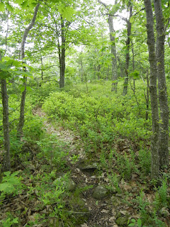
The red trail wound it's way up the slope and along the ridge. Some of the area here reminded me of Maine, with bare rocks and lots of blueberry bushes.
 |
| Cathles Trail. |
 |
| From the Finger Lakes Trail Conference website. |
 |
| Pink Corydalis |
 |
| Lady slipper. |
The views from the lookouts were quite impressive. We could see well to the north, past the Barndoor Hills in Granby, and east to the Metacomet Ridge and beyond.
 |
| Barndoor Hills in Granby. What is in the distance on the far left? |
 |
| Looking east across the Farmington Valley to the Metacomet Ridge. |
When we got to what we assumed was the final lookout, we turned around. While the Walkbook indicates that the red trail linked up with the blue trail on the west side of the ridge, some of the other maps indicate that the trail just ends. There did seem to be a narrow trail heading into the woods, but we decided to turn back. An adventure for another day, perhaps.
This was a great hike and much less strenuous than I feared. The Western Highlands offer tremendous views of the valley and a hike along the Hedgehog Trail is in our plans for the future.

No comments:
Post a Comment